Paraná receives a frost warning in this last week of autumn; see where and the weather forecast
⚡ Quick Summary
Meteorologist talks about weather forecast for Paraná this last week of autumn Winter will arrive on Sunday (21) and Paraná will be marked, in this last week of autumn, by the characteristics of the season: temperature range throughout the day, with freezing dawns and slightly warmer afternoons.
Meteorologist talks about weather forecast for Paraná this last week of autumn
Winter will arrive on Sunday (21) and Paraná will be marked, in this last week of autumn, by the characteristics of the season: temperature range throughout the day, with freezing dawns and slightly warmer afternoons.
The information comes from the Paraná Environmental Technology and Monitoring System (Simepar), whose frost alert indicates the formation of the phenomenon in part of the extreme south of the state at least this Tuesday (16), Wednesday (17) and Thursday (18).
✅Follow the g1 PR channel on WhatsApp
The agency released maps showing which regions are expected to be affected by frost in the first two days. See below.
Frost alert
Reproduction/Simepar
"Over the weekend, we had a cold front advance across the ocean, away from the coast, and the remnants of this system still maintain a lot of humidity, mainly in the east, Campo Gerais and also in the North and Northwest of Paraná. In these sectors, it should rain lightly at various times this Monday, with little variation in temperatures", explains Samuel Braun, meteorologist at Simepar.
Due to the action of a mass of cold and dry air, in the West and Southwest of Paraná the sun appears more intensely, but temperatures do not rise much, says the agency.
On Tuesday (16), the day dawns again with the presence of many clouds, mainly from the central strip to the east of Paraná, but gradually the cloudiness and fog lose intensity. Then the sun, on Tuesday afternoon, appears in most of Paraná. See the weather forecast by region below.
"On Tuesday, also in the morning, it is cold in the Southwest and South, with minimums below 5°C and the possibility of light frost. In the afternoon, it warms up a little more in the North and Northwest, with maximums around 22°C to 24°C", highlights Samuel.
This temperature range continues on Wednesday (17) and Thursday (18), with the possibility of frost in the Southwest and South on Wednesday.
"These will be very typical autumn days in Paraná. A mass of cold air still acts over the state, favoring a dawn with low temperatures. Some fogs also act, mainly in Campos Gerais, Metropolitan Region of Curitiba and along the interior river valleys. During the morning, the fogs lose strength, the sun appears and in the afternoon it warms up", says Samuel.
However, the agency emphasizes that it will not get very hot; the highest temperatures will be close to 23°C in cities in the North and West of Paraná - a difference of more than ten degrees from the temperatures recorded at dawn in cities in these regions.
On Friday (19), another cold front moves in and changes the weather conditions.
"In the Northwest, West and Southwest, the risk of storms is a little higher in the morning. In other sectors of the state, the weather changes throughout the day", highlights Samuel.
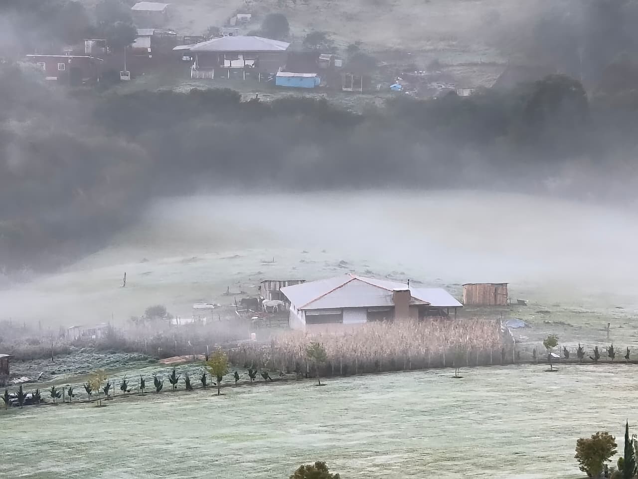
Frosts have already been recorded this year in Paraná
Eduardo Andrade/RPC
Also read:
Behind bars and dressed in pink: The story of the nuns of 'perpetual adoration' who live cloistered in Paraná
Agreement: Farmer who kept elderly couple in modern slavery for 20 years will pay R$70,000 to victims
Car fell into river: Man misses work, colleagues go looking for him and find him dead
Weather forecast for Paraná
See below the weather forecast updated this Monday (15) by Simepar:
Monday, June 15th
Monday, June 15th
Reproduction/Simepar
Tuesday, June 16
Tuesday, June 16
Reproduction/Simepar
Wednesday, June 17th
Wednesday, June 17th
Reproduction/Simepar
Thursday, June 18
Thursday, June 18
Reproduction/Simepar
Friday, June 19
Friday, June 19
Reproduction/Simepar
Most watched videos from g1 Paraná:
Read more news on g1 Paraná
🗞️ 4 sources covered this story

Luciana Gimenez's son blasts Nicki Minaj and receives a wave of attacks
CNN Brasil
This week's two polls on the Haddad x Tarcísio dispute in São Paulo
CartaCapital
Weather forecast in SP: see when it rains in the capital of São Paulo this week
CNN BrasilSee the weather forecast for Boa Vista this week
CNN Brasil📰 Related Articles
Woman reacts to robbery and tries to prevent criminals from escaping on Orla Bardot, in Búzios; VIDEO
G1 Globo
VIDEO: Luan Santana sees a poster with a fan's request and invites the pregnant woman to the stage for a revelation tea during a show in Paraná
G1 Globo
Médio Tejo has a plan for municipalities vulnerable to fires
Observador
Until what age should children sleep in their parents' bed?
Observador
Drunk driver arrested after running over street cleaner who worked in DF
G1 Globo